Abstract
Satellite-based radar retrieval methods are widely employed to fill coverage gaps in ground-based radar systems,
especially in remote areas affected by terrain blockage and limited detection range.
Existing methods predominantly rely on overly simplistic spatial-domain architectures constructed from a single data source,
limiting their ability to accurately capture complex precipitation patterns and sharply defined meteorological boundaries.
To address these limitations, we propose WaveC2R, a novel wavelet-driven coarse-to-refined framework for radar retrieval.
WaveC2R integrates complementary multi-source data and leverages frequency-domain decomposition to separately model low-frequency components for capturing precipitation patterns and high-frequency components for delineating sharply defined meteorological boundaries.
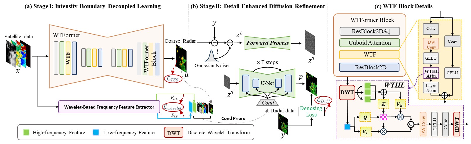
Specifically, WaveC2R consists of two stages (i) Intensity-Boundary Decoupled Learning,
which leverages wavelet decomposition and frequency-specific loss functions to separately optimize low-frequency intensity and high-frequency boundaries;
and (ii) Detail-Enhanced Diffusion Refinement, which employs frequency-aware conditional priors and multi-source data to progressively enhance fine-scale precipitation structures while preserving coarse-scale meteorological consistency.
Experimental results on the publicly available SEVIR dataset demonstrate that WaveC2R achieves state-of-the-art performance in satellite-based radar retrieval, particularly excelling at preserving high-intensity precipitation features and sharply defined meteorological boundaries. Our project is available at https://spring-lovely.github.io/WaveC2R/.